GPS Map Software for CAD, GIS, Outdoor Recreation, and Geocaching
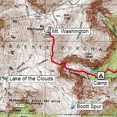
Since 1998, TopoGrafix has delivered affordable desktop mapping software for outdoor enthusiasts and professionals who use GIS and CAD. Our flagship product, ExpertGPS, allows anyone to view data from a Garmin, Magellan or Lowrance GPS receiver over seamless topo maps and aerial photography. Combining powerful data management capabilities with a full set of USGS topographic maps and aerial photos, ExpertGPS gives you the map tools you need to create, view, and modify maps of your adventures. To get the most out of your maps and GPS, you need ExpertGPS mapping software for GPS.
ExpertGPS Pro combines GIS layering with seamless mapping and one-click data transfers to any Garmin, Magellan, or Lowrance GPS receiver. View and edit GIS layers and shapefiles directly over aerial imagery. Transfer your GIS data to any handheld GPS receiver and print maps with data overlays for use in the field. Import field-checked waypoints and tracks back into your GIS.
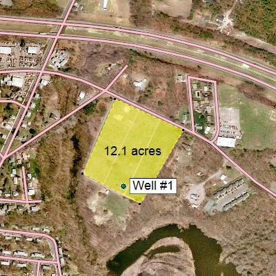
CAD/DXF conversion in ExpertGPS Pro allows you to import AutoCAD drawings in DXF format and view them with seamless mapping and one-click data transfers to any Garmin, Magellan, or Lowrance GPS receiver. View your engineering drawings over topo maps and aerial photos, and combine them with field data collected with any handheld Garmin, Magellan, or Lowrance GPS receiver.
Convert your DXF drawings to Google Earth's KML format, and see them on top of the latest color imagery. Send boundaries and other CAD features to your handheld GPS for use in the field.
Free GPS Software for Garmin, Magellan, and Lowrance GPS
Our free GPS software, EasyGPS is the perfect GPS waypoint and track manager for recreational GPS users and geocachers. Best of all, it's FREE!
Copyright 1998-2026 TopoGrafix – 24 Kirkland Dr, Stow, MA – Email: